

Open User Map
Turn your WordPress site into a living, collaborative map where visitors add locations and you approve them with zero coding.
AI tool Details
Explore More
Alternatives
About Open User Map
Open User Map is a revolutionary WordPress plugin that transforms the way you think about interactive maps. It is a game-changing tool that empowers you to create a dynamic, community-driven map on your website without any coding knowledge, without the need for a Google Maps API key, and without any complex setup. This innovative plugin is designed for website owners, community managers, local business directories, tourism boards, real estate agents, and event organizers who want to unlock the potential of user-generated content. The core value proposition of Open User Map is its ability to turn your static map into a living, breathing resource that your visitors can actively contribute to. With frontend submissions, approval workflows, and powerful customization options, you can harness the collective knowledge of your audience. Imagine a map where your visitors can add and edit locations, upload images, and provide details, all while you maintain full control through an intuitive approval system. This transformative plugin eliminates the technical barriers typically associated with interactive maps, allowing you to focus on building a vibrant community. With over 15,000 active installs and a perfect 100% five-star rating, Open User Map is the number two map plugin on WordPress.org, a testament to its reliability and game-changing impact. It is the ultimate solution for anyone looking to create a collaborative, engaging, and highly functional map experience that drives user interaction and delivers real value.
Features
Frontend Location Submissions and Editing
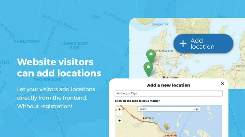
This transformative feature allows your website visitors to add and edit locations directly on the map from the frontend, completely bypassing the WordPress admin dashboard. By clicking an "Add location" button, users can place a marker, fill in details, and submit it for your approval. The editing capability empowers users to update their existing locations, ensuring the map always reflects the most current information. This game-changing functionality turns your visitors into active contributors, fostering a sense of community and ownership while dramatically reducing your workload.
Advanced Marker Categorization and Filtering
Unlock the potential of your map with this powerful organizational feature that allows you to group locations into distinct marker categories, each with its own unique icon. This setup not only clarifies the map's layout but also enables visitors to filter through different types of locations, such as restaurants, parks, or historical sites. For added flexibility, each location can belong to multiple categories, ensuring all relevant attributes are represented. This game-changing capability transforms a cluttered map into a highly intuitive and user-friendly navigation tool.
Lines and Areas Mapping
Go beyond simple location markers with this innovative feature that allows you to add routes, paths, zones, and regions directly to your map. Whether you need to highlight hiking trails, service areas, event grounds, neighborhoods, or construction zones, this tool lets you draw any custom shape that helps visitors understand your map at a glance. Distances and area sizes are calculated automatically, so routes and polygons can include helpful measurements right out of the box. This transformative functionality is perfect for showcasing complex spatial information in a clear and engaging way.
Custom Image as Map
This game-changing feature allows you to upload any image and transform it into a fully interactive map. Whether it is an overlay, floor plan, event layout, game map, product diagram, campus guide, or seating chart, you can allow users to place markers directly on top of it with the same powerful functionality as a traditional map. Add locations, display custom fields, enable filtering, and create an engaging, clickable experience tailored exactly to your use case. This feature unlocks a world of creative possibilities, breaking free from traditional geographic constraints.
Use Cases
Local Business and Service Directory
Transform your website into the ultimate local resource by allowing community members to add and rate their favorite businesses, restaurants, and service providers. With Open User Map, you can create a dynamic directory where users submit locations, categorize them by type, and add star ratings. The approval workflow ensures only accurate and appropriate listings go live. This game-changing use case empowers your community to build and maintain a comprehensive, up-to-date directory that becomes the go-to source for local information, driving traffic and user engagement.
Community-Driven Event and Activity Map
Unlock the potential of your community by creating a collaborative map for events, meetups, and activities. Allow users to submit locations for farmers markets, festivals, sports events, or community gatherings. The advanced filter interface lets visitors search by date, category, or custom fields, making it easy to find what is happening nearby. This transformative use case turns your website into a central hub for community engagement, fostering connections and making it effortless for people to discover and participate in local happenings.
Interactive Campus and Facility Guide
Revolutionize the way visitors navigate your university campus, corporate headquarters, or large facility. Upload a custom floor plan or campus map as an image and let users place markers for buildings, departments, restrooms, parking lots, and points of interest. The Lines and Areas feature can highlight walking paths or restricted zones. This game-changing use case provides an intuitive, self-service wayfinding solution that reduces confusion and enhances the visitor experience, all without the need for expensive custom development.
Tourism and Travel Guide Website
Empower travelers to become your content creators with a transformative tourism map. Allow visitors to add hidden gems, scenic viewpoints, hiking trails, and recommended hotels. Use the star rating and upvote features to let the community highlight the best locations. The Regions feature can create boundaries for neighborhoods or districts, helping users explore specific areas. This use case unlocks the potential of user-generated travel content, creating a rich, authentic, and constantly updated guide that attracts more visitors and establishes your site as an authority.
Frequently Asked Questions
Do I need a Google Maps API key to use Open User Map?
No, you do not need a Google Maps API key. This is one of the most game-changing aspects of Open User Map. The plugin is designed to work seamlessly without any external API keys, eliminating a common point of frustration and cost associated with other map plugins. You can set up and run your interactive map immediately after installation without any complex configuration.
Can I moderate user submissions before they appear on the map?
Yes, absolutely. Open User Map includes a powerful approval workflow that gives you complete control over all user-generated content. When a visitor submits a new location or edits an existing one, it is held in a pending state for your review. You can then approve, edit, or reject the submission from your WordPress dashboard, ensuring only accurate and appropriate information is displayed on your public map.
Is it possible to customize the look and feel of my map?
Yes, Open User Map offers powerful customization options to ensure your map aligns with your brand and website design. You can change marker icons, customize colors, and create custom fields like text boxes, links, checkboxes, and dropdowns. The Advanced Filter Interface allows you to create a custom filter sidebar, and you can even add custom HTML content sections for additional information or branding.
Can I use my own image as a map instead of a geographic map?
Yes, this is a standout and game-changing feature of Open User Map. The "Custom Image as Map" feature allows you to upload any image, such as a floor plan, event layout, or product diagram, and turn it into a fully interactive map. Users can place markers on this image with the same functionality as a traditional map, including custom fields, filtering, and location details.
Similar to Open User Map

Built2WinWeb AI
Custom PHP websites, AI Indexing Pack ($599 one‑time), and WebAgentScan SaaS ($9/mo). MCP, A2A, llms.txt, full ownership.
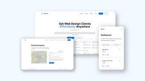
Webleadr
Webleadr transforms lead generation by helping you effortlessly find and contact businesses without websites in just a few clicks.

Idearium
Idearium crafts impactful websites and marketing strategies that elevate your brand and drive meaningful growth.

FilexHost
Transform your files into instantly shareable links with effortless drag and drop hosting.

Crawlkit
CrawlKit transforms the web into structured data with a single API call, empowering developers to extract and monitor.
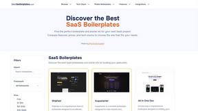
Best Boilerplates
Unlock rapid SaaS success by comparing and choosing the perfect development boilerplate.

Shadcn UI Kit
Accelerate your development with Shadcn UI Kit's ready-to-use templates, components, and admin dashboards for React.